Submitting records is easy. You can enter records through this website, or through our app. Find out about the app here.
First, you need to register on the website or log in to submit records. This is so that if there are any queries regarding your records we can contact you. It also allows you to manage your own records, generate maps of your sightings and so on. Once you have logged on, use the data entry forms under Submit your records to enter your sightings. The minimum information need is date, location and species. Of course, the more information you can provide, the better.
If you use the app, use the same first name and last name that you used to register on the website, so that all of your records can be attributed to you whether submitted through the website or the app.
How to enter your records:
1. What did you see?
Here you tick the species you recorded. For each one, choose the appropriate Sighting type. You can upload photos for your records using the Add images button.
If you are recording mammals/carnivores and you saw several animals, you can indicate their age and sex by filling in the columns. The categories are:
- Adult (abbreviated to Ad)
- Subadult (SAd)
- Juvenile (Juv)
- Unknown age (Unk)
- Male (M)
- Female (F)
- Unknown sex (U)
Once you have filled in this page, use the Next step button at the bottom of the page, or click on the 2. Where was it? link at the top of the page.
2. Where was it?
This is where you enter information on the location of your record. There are several ways to enter the location of the data record. These are described in detail in the downloadable Guidelines on how to enter a location.
Coordinates:
The simplest is to click on the map. Leave the drop-down box set on WGS84 (decimal, lat, long). Use the controls on the left to zoom in to find the location and then click. The coordinates will be generated and entered in this format: 20.922S 16.67444E. You can also choose to type in coordinates manually, in the same format.
Quarter degree square:
Change the drop-down list to QDS (quarter degree square). Then you can either zoom in to the relevant area of hte map and click to generate the QDS code or simply type in grid reference for the square in this format: 2217CA.
Monad:
Change the drop-down list to Monad (1km x 1km) and click or enter a code, as per QDS.
Pentad:
Change the drop-down list to Pentad (5km x 5km) and click or enter a code, as per QDS.
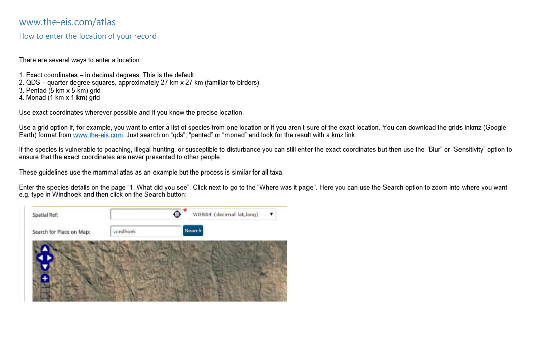
You can use the Search for Place on Map button to quickly go to a location (town).
Once you have filled in this page, use the Next step button at the bottom of the page, or click on the 3. Other information link at the top of the page.
3. Other information
Use the date picker to find the date for your record or you can type it in using this format: 01/10/2015 for 1st of October 2015. You can add any notes or comment in the Overall comment box. This is for any information that relates to all recrds you have entered, such as weather. Individual notes for each species should be entered in the 1. What did you see? page.
Once you have filled in this page, use the Save button at the bottom of the page, or click on the 4. Submit record link at the top of the page.
4. Submit record
When the record is successfully submitted you should see a confirmation message.