Namibia's one-stop shop for environmental information
map
A representation, normally on a flat medium, that displays the physical and political features of a surface area of the earth, showing them in their respective forms, sizes and relationships according to some convention of representation. (Source: RHW)
The listing below shows all records tagged with this term.
The records can be filtered using the search boxes. Or leave this page and do a full search of all records.
Displaying results 101 - 150 of 168 record(s) tagged with this keywordClick/tap on any title to see full details of the record
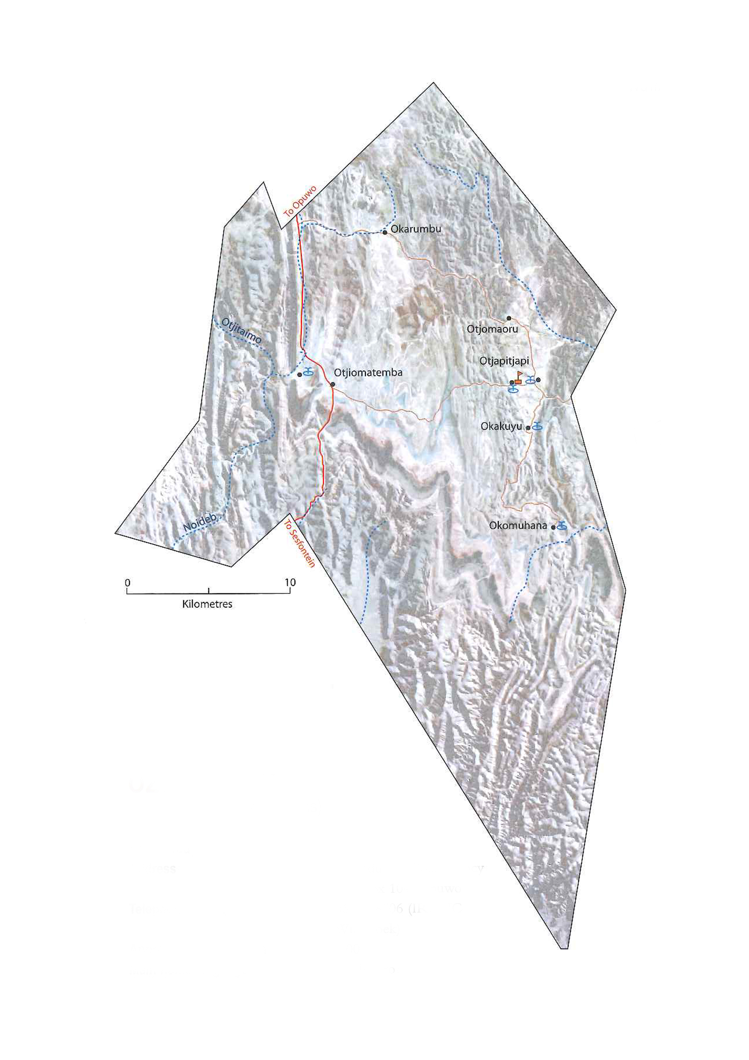
2009. Ozondundu Conservancy Profile Map 2009.
Downloadable files:
| Attachment | Size |
|---|---|
| Ozondundu Conservancy Profile Map 2009.jpg | 1.7 MB |
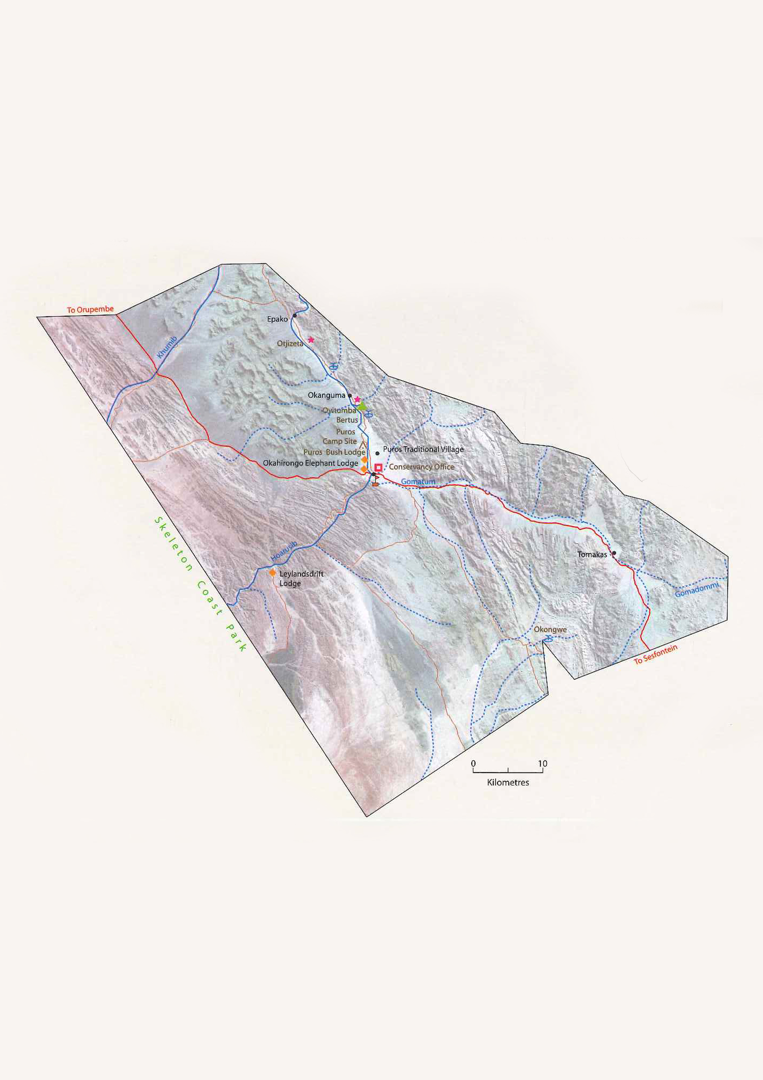
2009. Puros Conservancy Profile Map 2009.
Downloadable files:
| Attachment | Size |
|---|---|
| Puros Conservancy Profile Map 2009.jpg | 1.73 MB |
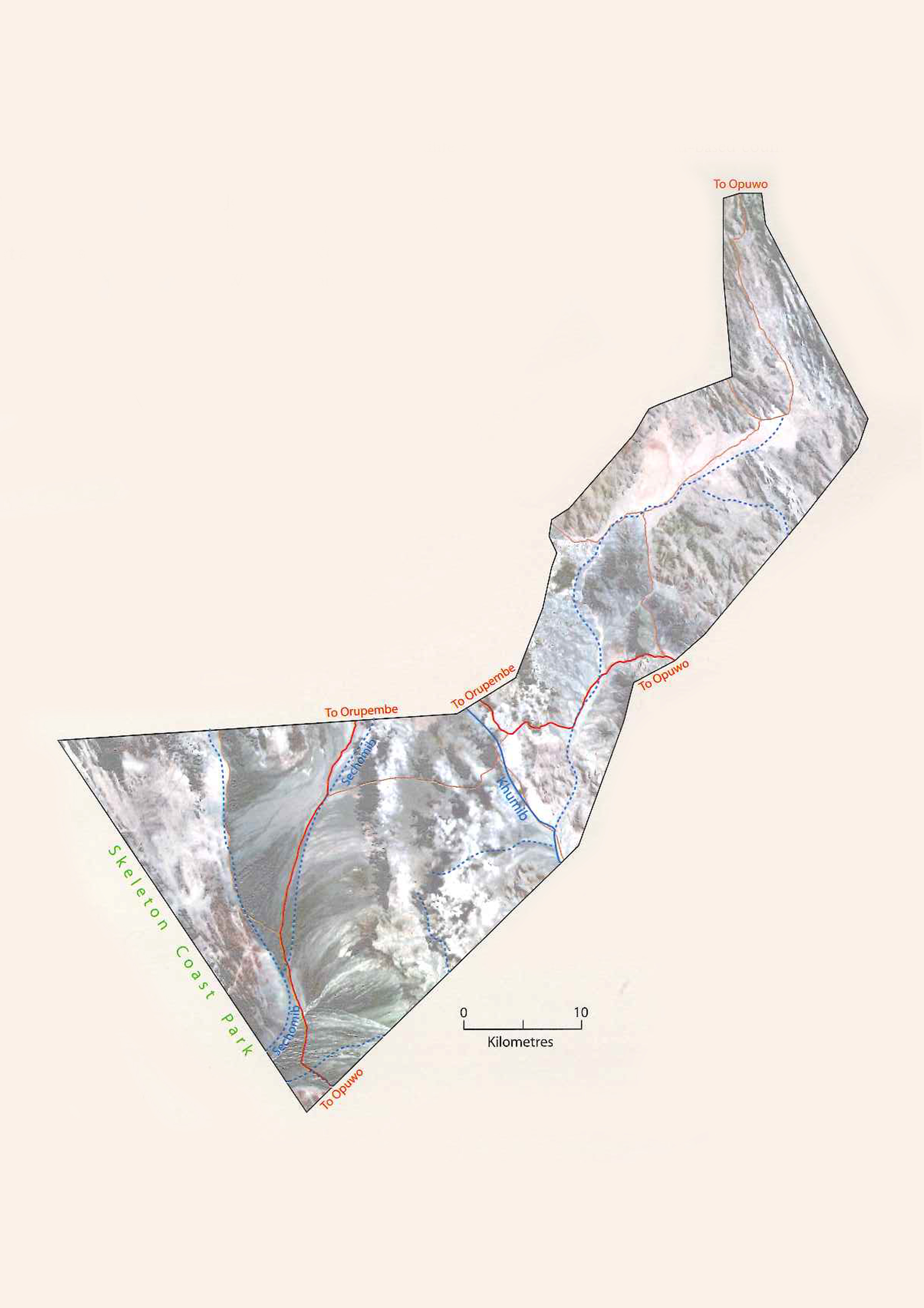
2009. Sanitatas Conservancy Profile Map 2009.
Downloadable files:
| Attachment | Size |
|---|---|
| Sanitatas Conservancy Profile Map 2009.jpg | 1.42 MB |
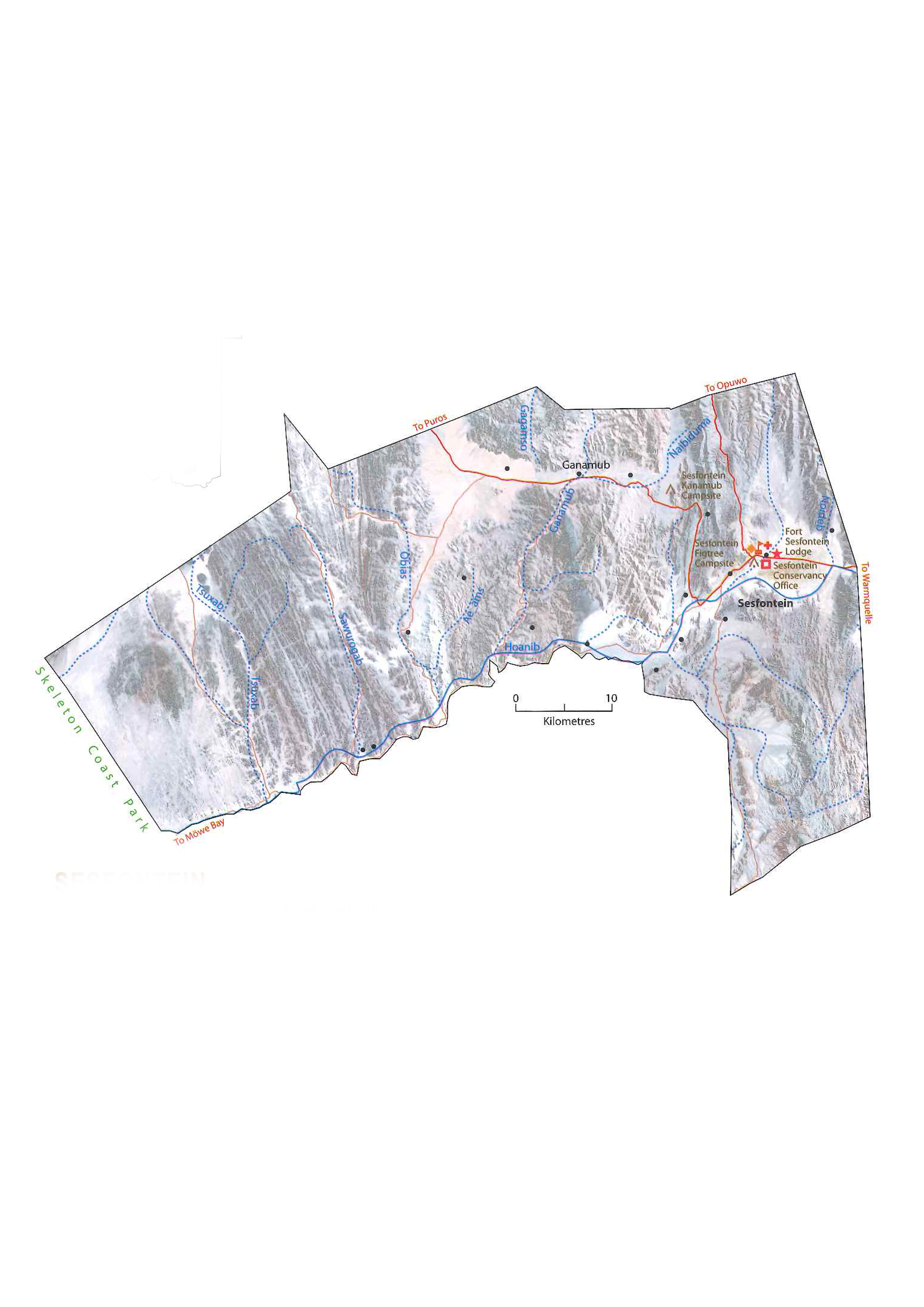
2009. Sesfontein Conservancy Profile Map 2009.
Downloadable files:
| Attachment | Size |
|---|---|
| Sesfontein Conservancy Profile Map 2009.jpg | 1.67 MB |
2009. Shamungwa Conservancy Profile Map 2009.
Downloadable files:
| Attachment | Size |
|---|---|
| Shamungwa Conservancy Profile Map 2009.jpg | 1.5 MB |
2009. Sheya Shuushona Conservancy Profile Map 2009.
Downloadable files:
| Attachment | Size |
|---|---|
| Sheya Shuushona Conservancy Profile Map 2009.jpg | 1.57 MB |
2009. Sorris Sorris Conservancy Profile Map 2009.
Downloadable files:
| Attachment | Size |
|---|---|
| Sorris Sorris Conservancy Profile Map 2009.jpg | 1.69 MB |
2009. Torra Conservancy Profile Map 2009.
Downloadable files:
| Attachment | Size |
|---|---|
| Torra Conservancy Profile Map 2009.jpg | 2.1 MB |
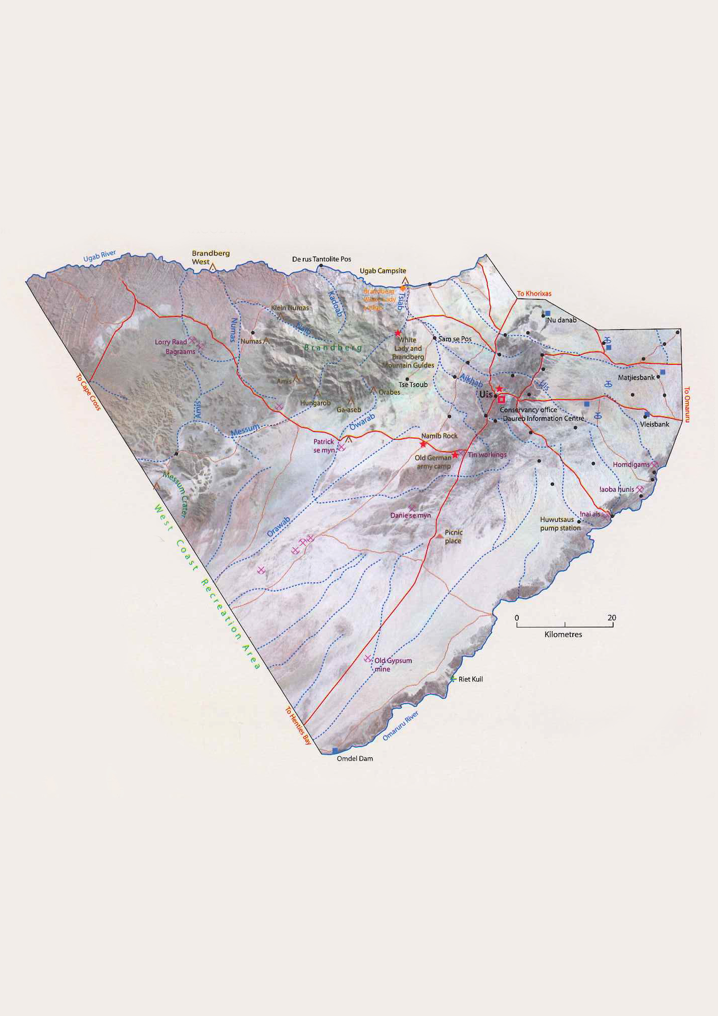
2009. Tsiseb Conservancy Profile Map 2009.
Downloadable files:
| Attachment | Size |
|---|---|
| Tsiseb Conservancy Profile Map 2009.jpg | 1.99 MB |
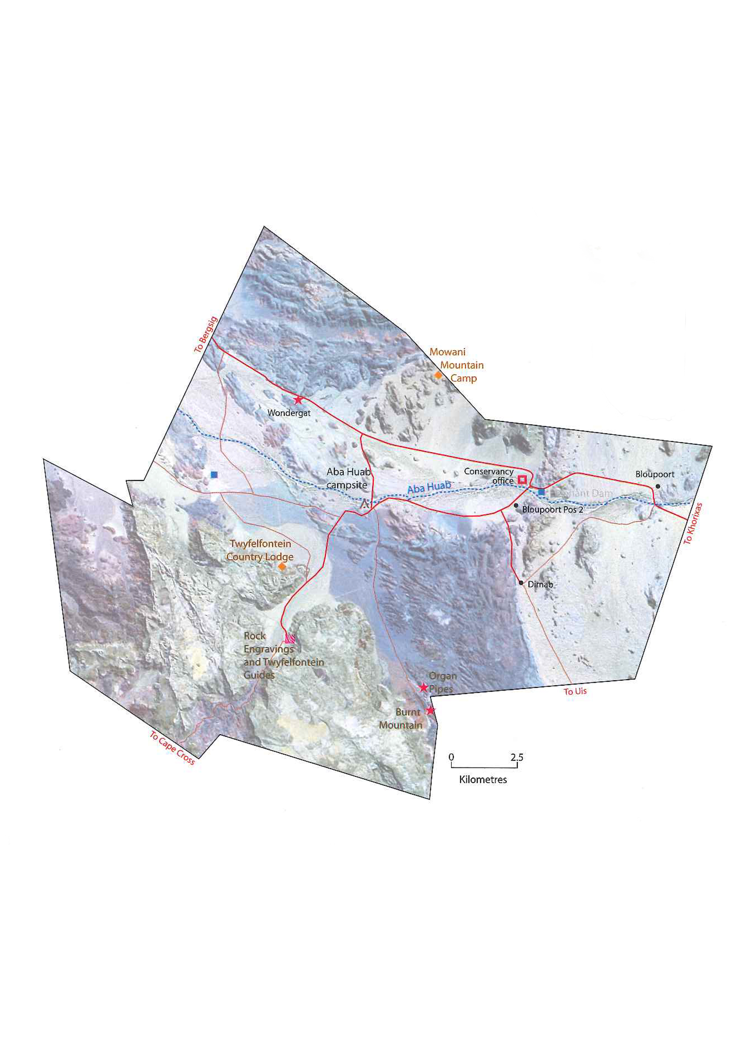
2009. Uibasen Twyfelfontein Conservancy Profile Map 2009.
Downloadable files:
| Attachment | Size |
|---|---|
| Uibasen Twyfelfontein Conservancy Profile Map 2009.jpg | 1.78 MB |
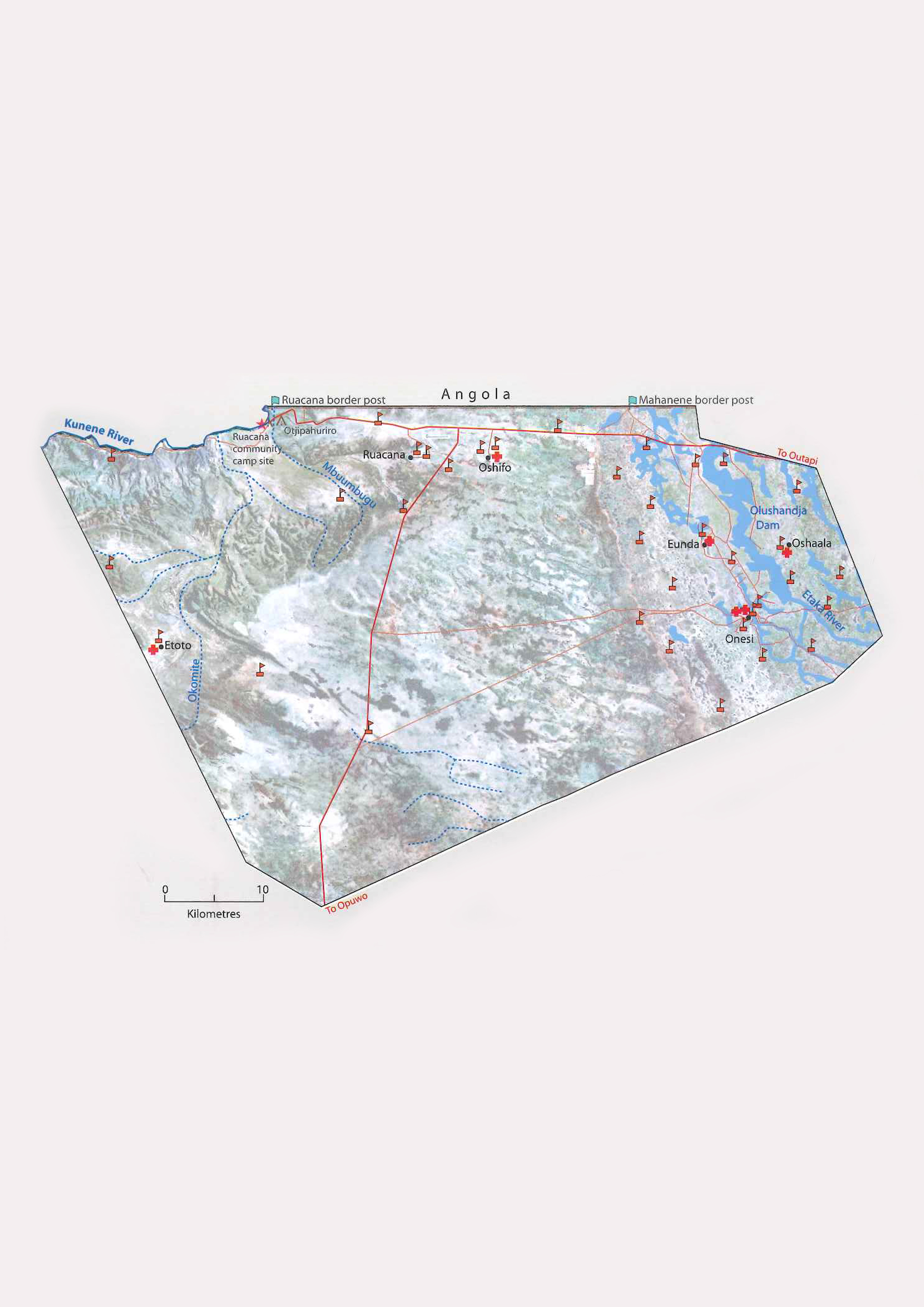
2009. Uukolonkadhi-Ruacana Conservancy Profile Map 2009.
Downloadable files:
| Attachment | Size |
|---|---|
| Uukolonkadhi_Ruacana Conservancy Profile Map 2009.jpg | 1.74 MB |
2009. Uukwaluudhi Conservancy Profile Map 2009.
Downloadable files:
| Attachment | Size |
|---|---|
| Uukwaluudhi Conservancy Profile Map 2009.jpg | 1.74 MB |
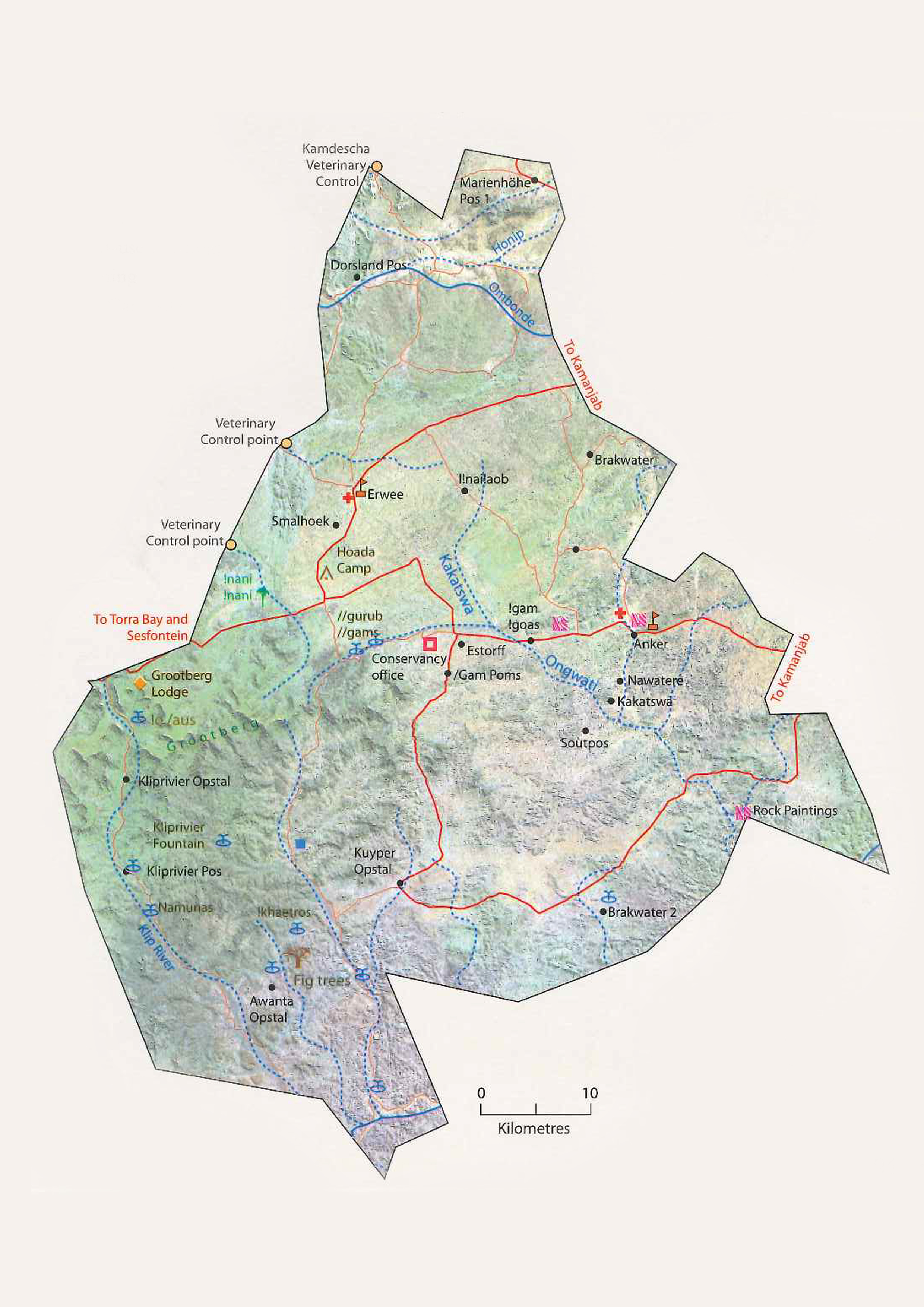
2009. ≠Khoadi-//Hôas Conservancy Profile Map 2009.
Downloadable files:
| Attachment | Size |
|---|---|
| Khoadi_Hoas Conservancy Profile Map 2009.jpg | 2.37 MB |
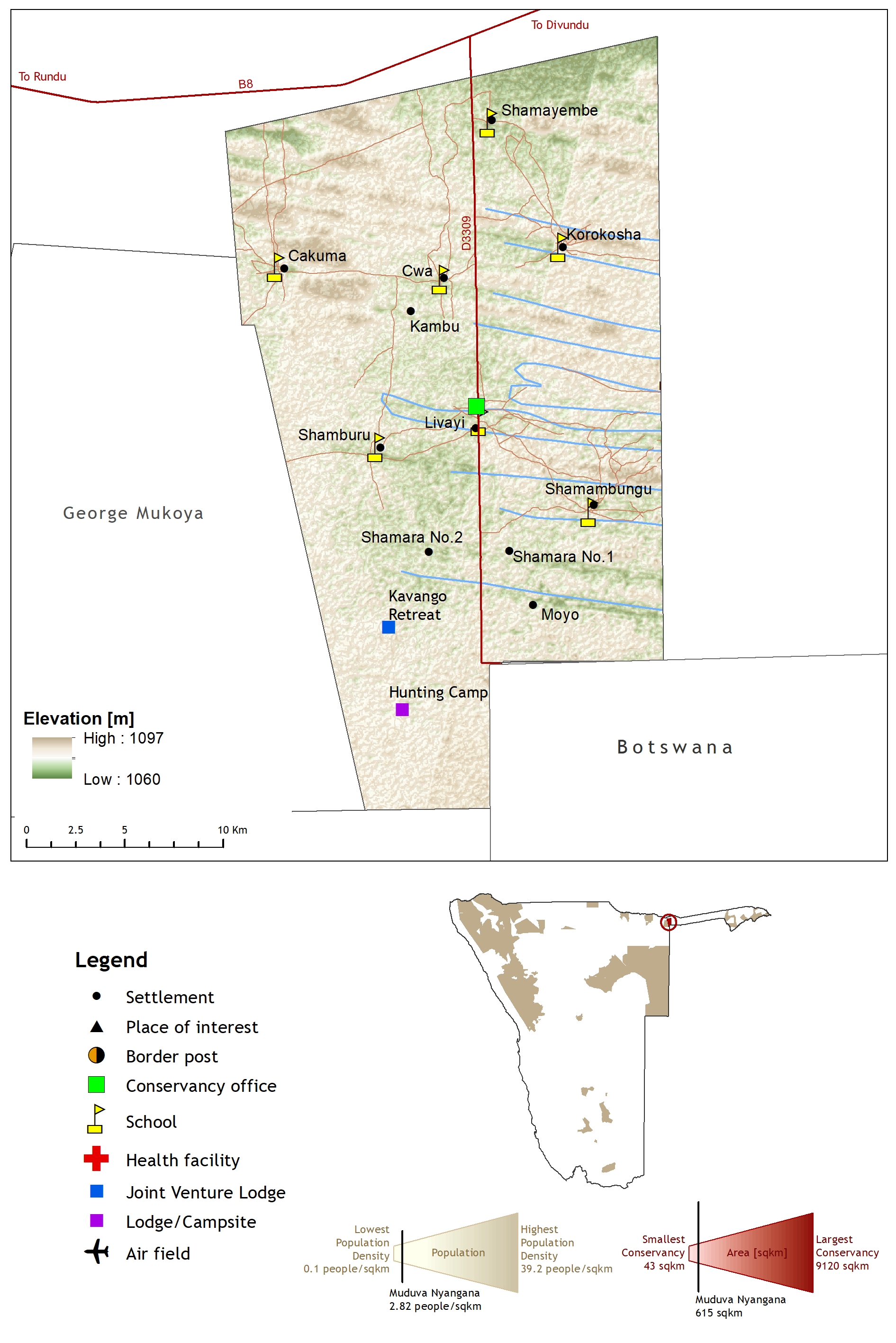
2019. Muduva Nyangana Conservancy Profile Map 2019.
Downloadable files:
| Attachment | Size |
|---|---|
| Muduva Nyangana Conservancy Profile Map 2019.jpg | 1.61 MB |
2012. New maps representing the historical and recent distribution of the African species of rhinoceros: Diceros bicornis, Ceratotherium simum and Ceratotherium cottoni. Pachyderm (52) 91-96
Downloadable files:
| Attachment | Size |
|---|---|
| 2013 Rookmaaker 212 Maps Africa - Pachyderm.pdf | 568.24 KB |
2008. Maps and memory, rights and relationships: articulations of global modernity and local dwelling in delineating land for a communal-area conservancy in north-west Namibia.
Downloadable files:
| Attachment | Size |
|---|---|
| Maps and memory_rights and relationships_Sullivan_2008.pdf | 3.88 MB |
1976. An outline of the vegetation of the Okavango Drainage System. Proceedings of the Symposium on the Okavango Delta and its future utilization
92-112
Downloadable files:
| Attachment | Size |
|---|---|
| An outline of the vegetation of the Okavango Drainage System_1976.pdf | 8.31 MB |
1997. Use of image processing and GIS techniquies to determine the extent and possible causes of land management/fenceline induced degradation problems in the Okavango area, northern Botswana. International Journal of Remote Sensing
Downloadable files:
| Attachment | Size |
|---|---|
| Use of image processing and GIS techniquies_Ringrose_1997.pdf | 3.66 MB |
Legend of the FAO soil map of Africa.
Downloadable files:
| Attachment | Size |
|---|---|
| FAO soil map of Africa.pdf | 206.44 KB |
1997. Endemic birds of Namibia: Evaluating their status and mapping biodiversity hotspots.
Downloadable files:
| Attachment | Size |
|---|---|
| Research Discussion Paper 14_1997.pdf | 992.22 KB |
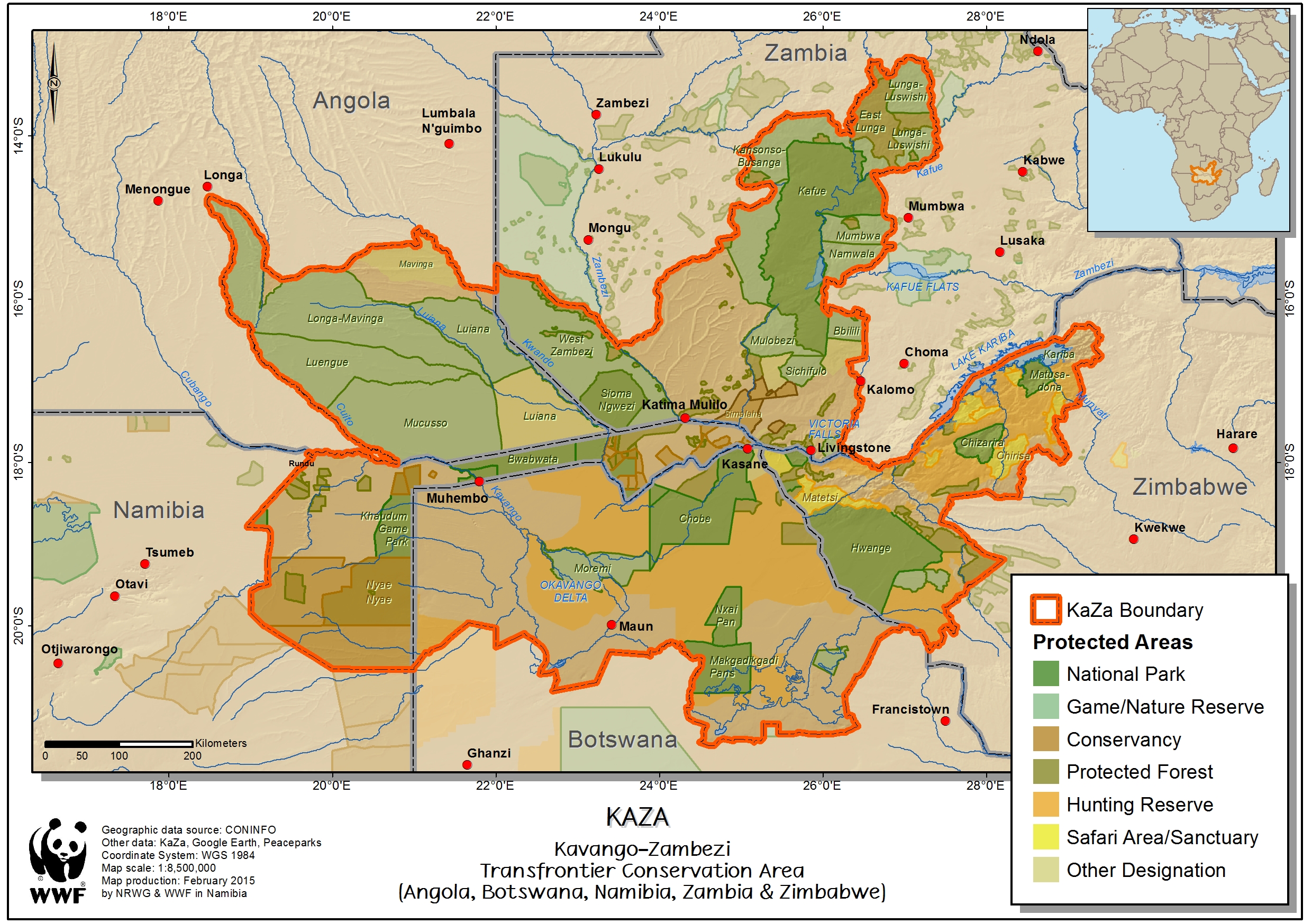
2015. KAZA Kavongo-Zambezi Transfrontier Conservation Area (Angola, Botswana, Namibia, Zambia and Zimbabwe).
Downloadable files:
| Attachment | Size |
|---|---|
| 2015_09 KAZA map.jpg | 2.23 MB |
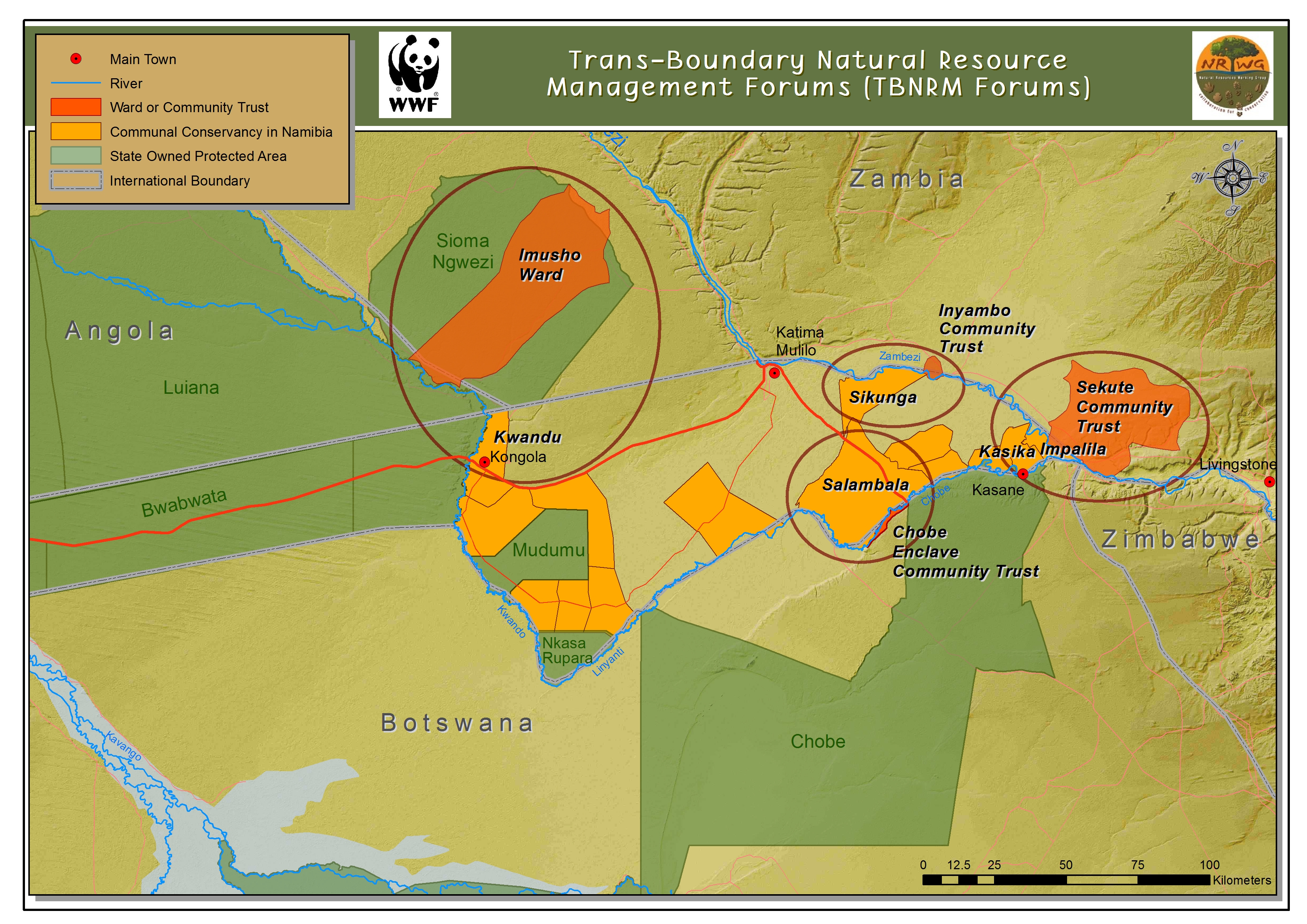
2015. Trans-Boundary Natural Resource Management Forums (TBNRM Forums) .
Downloadable files:
| Attachment | Size |
|---|---|
| TBNRM Forums Map 2015.jpg | 4.51 MB |
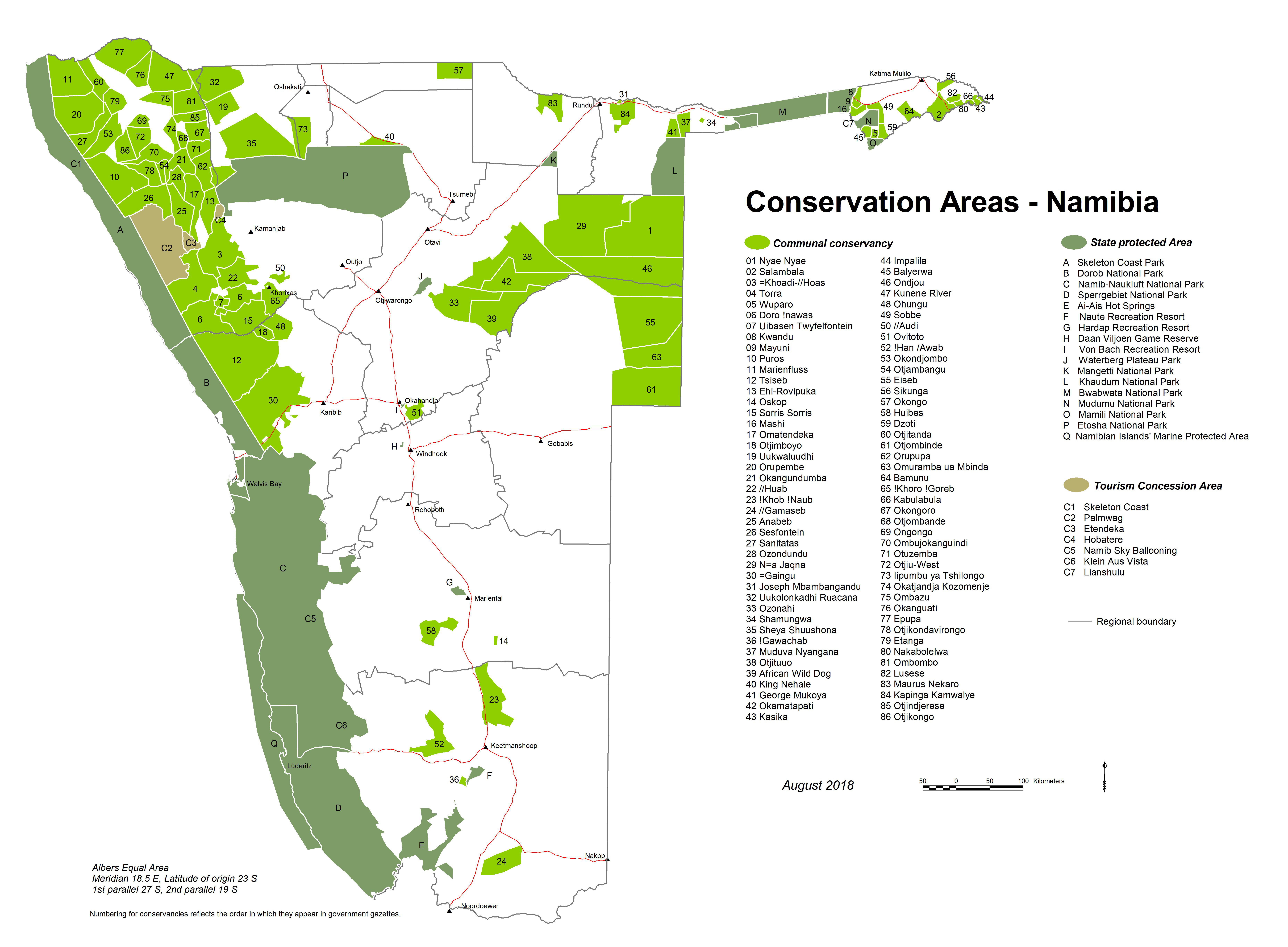
2018. Conservation Areas - Namibia.
Downloadable files:
| Attachment | Size |
|---|---|
| Protected_Areas_A3.jpg | 3.84 MB |
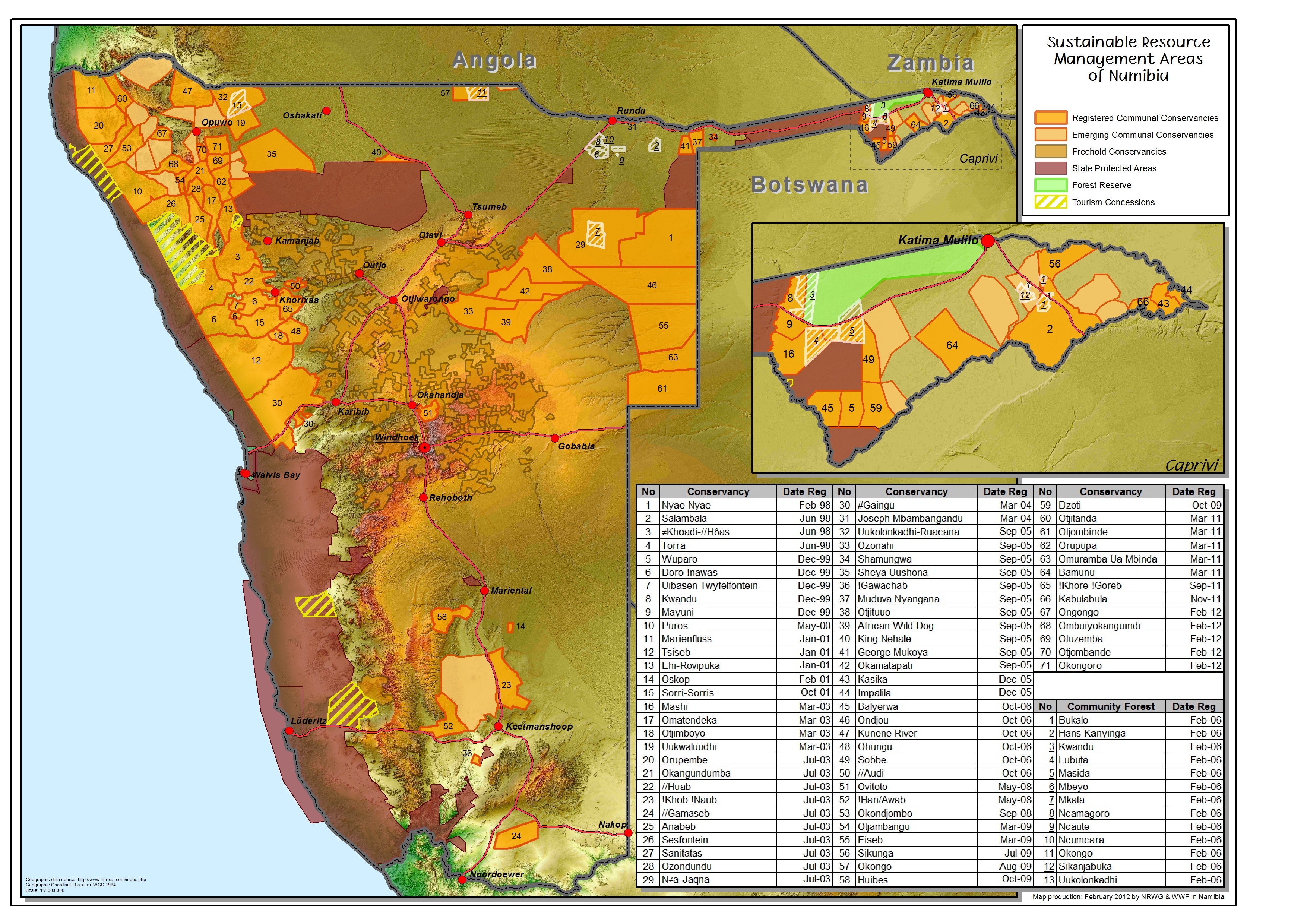
2018. Sustainable Resource Management Areas of Namibia.
Downloadable files:
| Attachment | Size |
|---|---|
| Conservancies map A4.jpg | 5.44 MB |
| Communal_conservancies_2018.zip | 10.48 MB |
2018. Registered Communal Conservancies - 2018.
Downloadable files:
| Attachment | Size |
|---|---|
| Conservancies_A1_2018.jpg | 8.78 MB |
| Conservancies_A1_2018.zip | 3.95 MB |
2018. Registered Communal Conservancies - 2018.
Downloadable files:
| Attachment | Size |
|---|---|
| Conservancies_A3_2018.jpg | 3.41 MB |
| Conservancies_A3_2018.zip | 2.11 MB |
2018. Registered Communal Conservancies - 2018.
Downloadable files:
| Attachment | Size |
|---|---|
| Conservancies_A4_2018.jpg | 2.62 MB |
| Conservancies_A4_2018.zip | 2.19 MB |
2010. Towards a user-friendly vegetation map of Namibia: ground truthing approach to vegetation mapping. In: Schmiedel, U., Jürgens, N. (Eds.):rnBiodiversity in southern Africa. Volume 2: Patterns and processes at regional scale: 45–56, Klaus Hess Publishers, Göttingen and Windhoek. Biodiversity in southern Africa
2
Downloadable files:
| Attachment | Size |
|---|---|
| Towards a user_friendly vegetation map of Namibia.pdf | 18.65 MB |
1926. Distribution of game in South West Africa - District map.
Downloadable files:
| Attachment | Size |
|---|---|
| South West Africa_District Map_1926.pdf | 1.96 MB |
Angola in old maps - Exploring Angola through European maps.
Downloadable files:
| Attachment | Size |
|---|---|
| Angola in old maps.pdf | 5.2 MB |
2010. Hydrogeological Mapping Procedures and Guidelines - SADC Hydrogeological Mapping Project.
Downloadable files:
| Attachment | Size |
|---|---|
| SADC Hydrogeological Mapping Procedures Standards and Guidelines 2010.pdf | 2.62 MB |
2022. Figure 08_02 Major farm products and land uses.
Downloadable files:
| Attachment | Size |
|---|---|
| Atlas_ch_08_02.zip | 3.23 MB |
Sustainable Resources Management Areas of Namibia.
Downloadable files:
| Attachment | Size |
|---|---|
| Sustainable resource management areas of Namibia.jpg | 3.69 MB |
Information for a series of historical maps to be included in the atlas being prepared by the Ministry of Environment and Tourism from Dr Jeremey Silvester (History Dept. UNAM).
Downloadable files:
| Attachment | Size |
|---|---|
| Information_for_a_series_of_historical_maps_to_be_included_in_the_new_atlas.pdf | 924.59 KB |
From the rock to the map.
Downloadable files:
| Attachment | Size |
|---|---|
| From the rock to the map.pdf | 1.57 MB |
2023. The highlands and escarpments of Angola and Namibia: orientation maps. Namibian Journal of Environment 8 1-6
Downloadable files:
| Attachment | Size |
|---|---|
| The highlands and escarpments of Angola and Namibia_orientation maps.pdf | 2.65 MB |
1991. World map of the status of human-induced soil degradation. An explanatory note.
Downloadable files:
| Attachment | Size |
|---|---|
| World map of the status of human-induced soil degradation_1991.pdf | 4.87 MB |
2012. Monthly Burned Area Report, August 2012.
Downloadable files:
| Attachment | Size |
|---|---|
| MAWF_Monthly Burned Area Report September 2012.pdf | 1.75 MB |
2012. Monthly Burned Area Report, September 2012.
Downloadable files:
| Attachment | Size |
|---|---|
| MAWF_Monthly Burned Area Report August 2012.pdf | 1.55 MB |
2012. Quantitative maps of groundwater resources in Africa.
Downloadable files:
| Attachment | Size |
|---|---|
| Ground water resources of Africa 1748-9326_7_2_024009.pdf | 1.06 MB |
2011. The Cuvelai-Etosha Basin.
Downloadable files:
| Attachment | Size |
|---|---|
| Cuvelai_poster_Orientation_lowres.pdf | 659.23 KB |
1998. Production of an Agro-Ecological Zones Map of Namibia (first approximation). Part II: Results. Map 2: Agro-ecological Zones of Namibia. Agricola
10
Downloadable files:
| Attachment | Size |
|---|---|
| Production of an Agro Ecological Zones Map of Namibia_Part II_Map II_1998.PDF | 25.85 MB |
1998. Production of an Agro-Ecological Zones Map of Namibia (first approximation). Part II: Results. Map 1: Growing Period Zones of Namibia. Agricola
10
Downloadable files:
| Attachment | Size |
|---|---|
| Production of an Agro Ecological Zones Map of Namibia_Part II_Map I_1998.PDF | 15.73 MB |
1998. Production of an Agro-Ecological Zones Map of Namibia (first approximation). Part II: Results. Agricola
10 33 - 43
Downloadable files:
| Attachment | Size |
|---|---|
| Production of an Agro Ecological Zones Map of Namibia_Part II_1998.pdf | 842.44 KB |
1998. Production of an Agro-Ecological Zones Map of Namibia (first approximation). Part I: Condensed methodology. Agricola
10 27 - 31
Downloadable files:
| Attachment | Size |
|---|---|
| Production of an Agro Ecological Zones Map of Namibia_Part 1_1998.pdf | 430.48 KB |
2000. Isohyetal rainfall map for the south-eastern part of Namibia. Agricola
11 7 - 9
Downloadable files:
| Attachment | Size |
|---|---|
| Isohyetal rainfall map for the south_eastern part of Namibia_2000.pdf | 1.13 MB |
2008. Mapping the major catchments of Namibia. Agricola
18 66
Downloadable files:
| Attachment | Size |
|---|---|
| Mapping the major catchments of Namibia_2008.pdf | 1.01 MB |
2005. Towards an updated carrying capacity map for Namibia: A review of the methodologies currently used to determine carrying capacity in Namibia. Agricola
15 33 - 39
Downloadable files:
| Attachment | Size |
|---|---|
| Towards an updated carrying capacity map for Namibia_2005.pdf | 3.28 MB |
2009. On the Suitability of MODIS Time Series Metrics to Map Vegetation Types in Dry Savanna Ecosystems: A Case Study in the Kalahari of NE Namibia. Remote Sensing
1 (4) 620 - 643
Downloadable files:
| Attachment | Size |
|---|---|
| On the Suitability of MODIS Time Series Metrics to Map Vegetation Types in Dry Savanna Ecosystems.pdf | 5.07 MB |