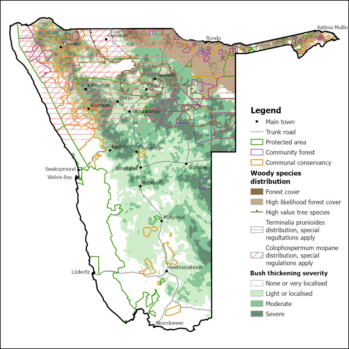
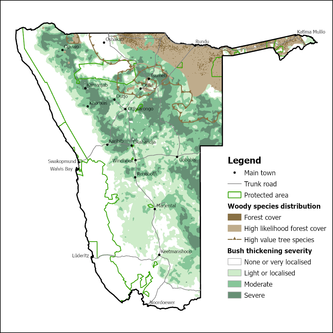
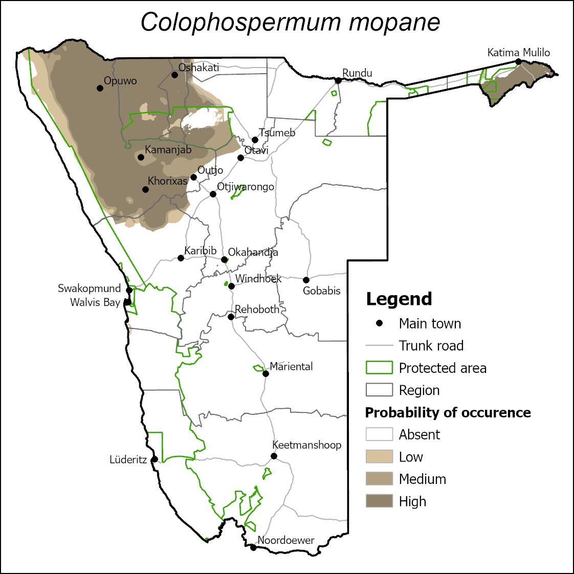
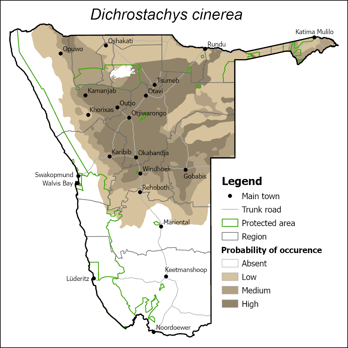
Bush thickening (also referred to as bush encroachment), reduces ecosystem services such herbaceous forage production, biodiversity of many organisms and ground water recharge over vast tracks of land in Namibia, which impacts ecosystems and people’s livelihoods negatively. The most used map is the one produced and agreed upon during the drafting of the 2016 "Strategic Environmental Assessment of Large-Scale Bush Thinning and Value Addition Activities in Namibia" led by the Southern African Institute for Environmental Assessment (SAIEA). While the abovementioned map was largely based on consensus among experts and different available datasets, in 2018 the Bush Information System (BIS) was developed, constituting a remote sensing-based national map layers on bush cover and biomass in the country. There has however not been any effort to update the national overview maps with data from the BIS or other new data since then.
| Attachment | Size |
|---|---|
| Review and consolidation of Namibias bush thickening maps.pdf | 2.32 MB |
| archBush thickening A4 20240414.jpg | 934.3 KB |
| Final bush thickening map of Namibia 202400414.jpg | 68.38 MB |
| archBush thickening A4 simple 20240414.jpg | 658.47 KB |
| archFinal_Colophospermum_mopane.jpg | 417.11 KB |
| archFinal_Dichrostachys_cinerea.jpg | 496.83 KB |
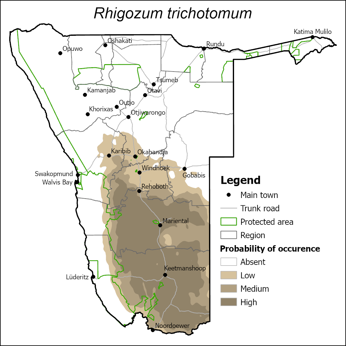
| archFinal_Rhigozum_trichotomum.jpg | 444.58 KB |
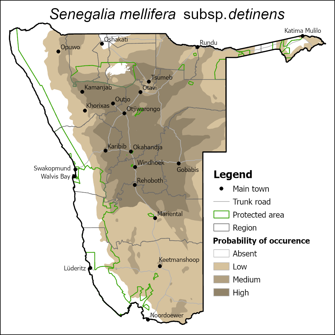
| archFinal_Senegalia mellifera subsp_detinens.jpg | 522.26 KB |
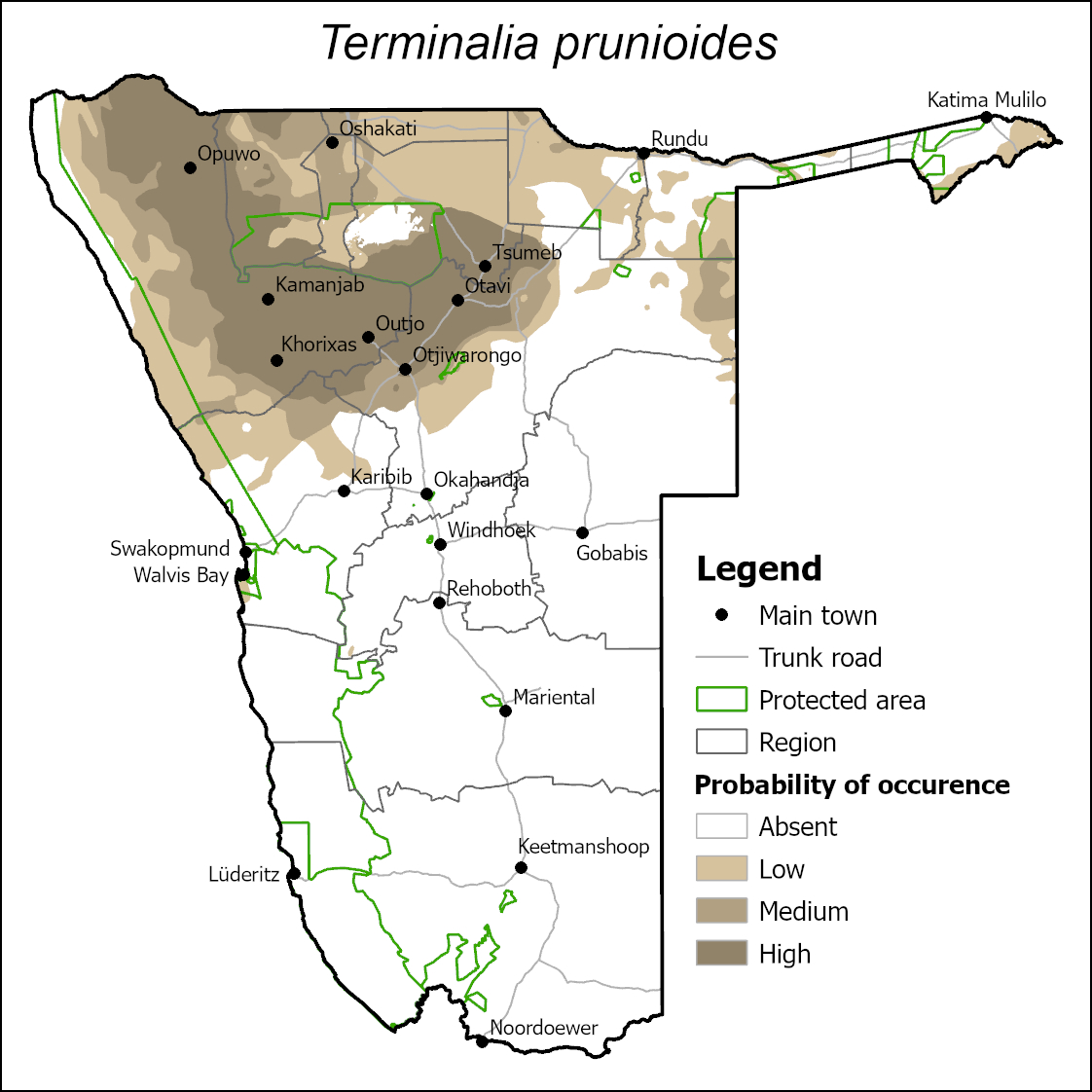
| archFinal_Terminalia_prunioides.jpg | 467.23 KB |
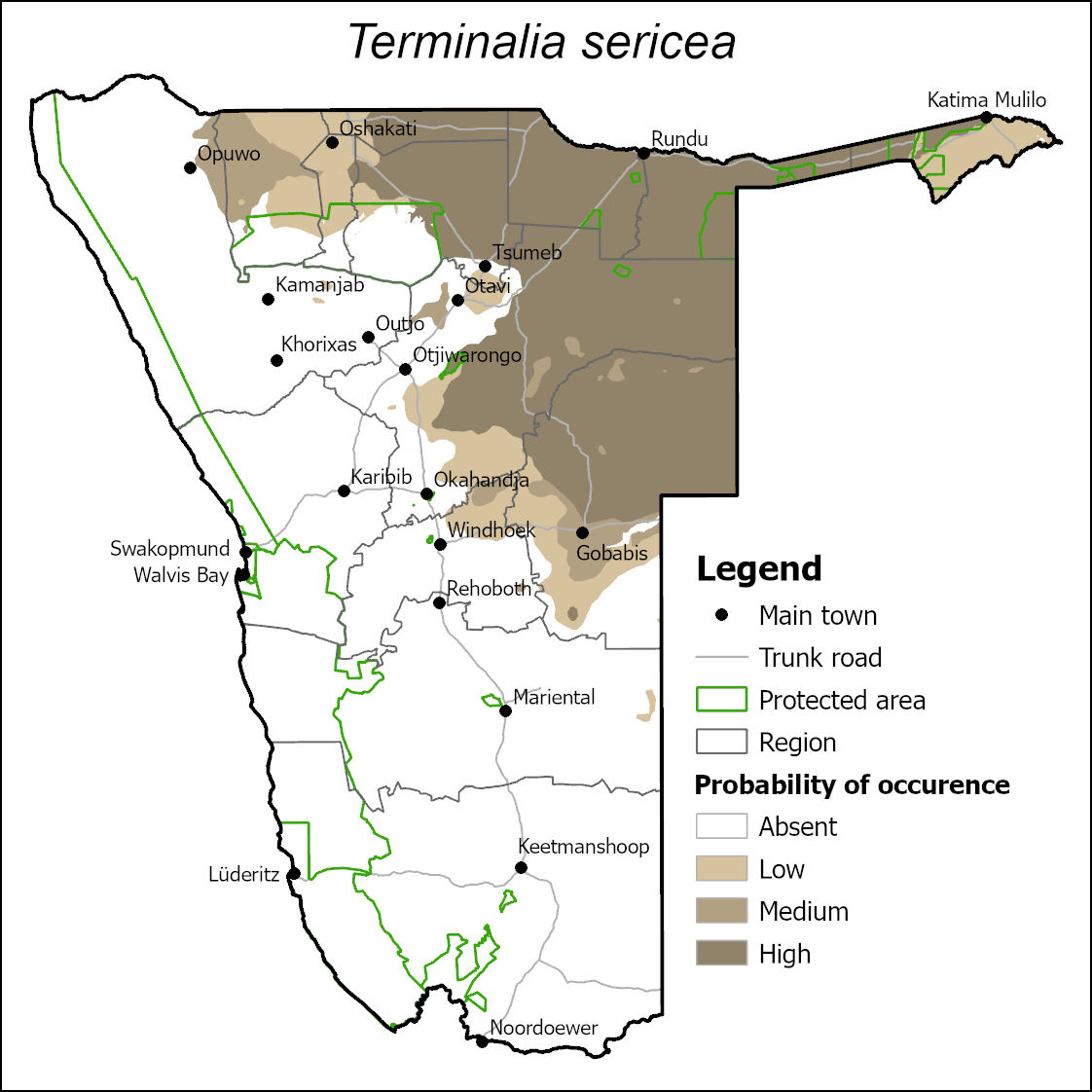
| archFinal_Terminalia_sericea.jpg | 439.92 KB |
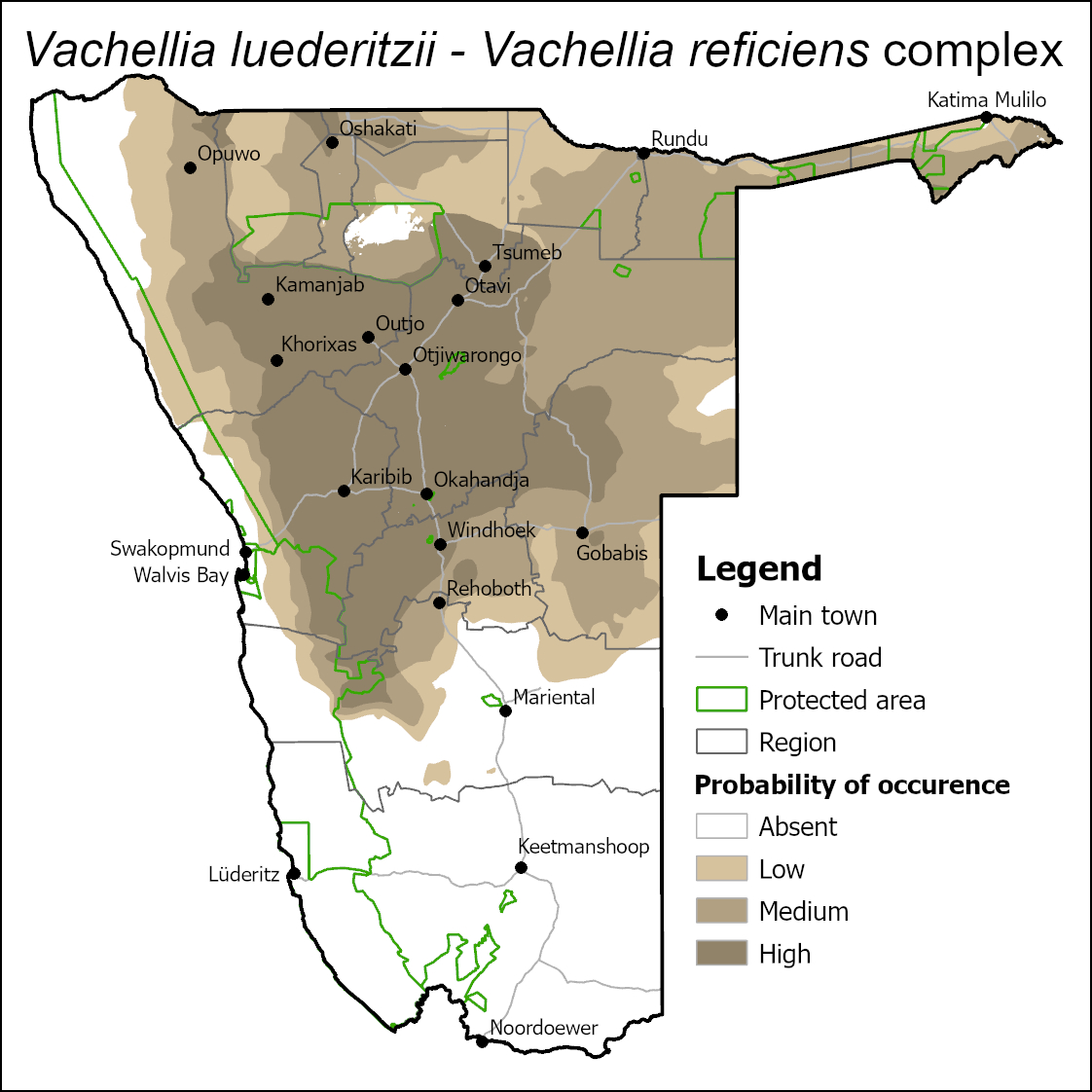
| archFinal_Vachellia luederitzii_Vachellia reficiens Complex.jpg | 503.76 KB |
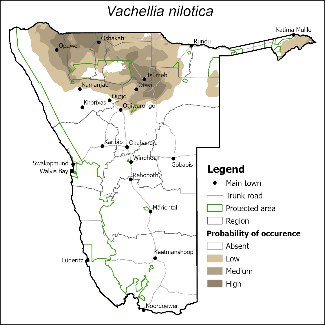
| archFinal_Vachellia nilotica.jpg | 437.66 KB |