


Recently added records
The following list of records includes verified records and those awaiting verification of species groups you are interested in which have been recently added in your area.
- Rat, House/Black(Rattus rattus)
22.67431S 14.52363E on 24/05/2026 by Walters, Matthew - Cheetah(Acinonyx jubatus)
17.80833S 23.14167E on 08/05/2026 by Walters, Matthew - Jackal, Side-striped(Canis adustus)
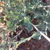
17.775S 23.30833E on 08/05/2026 by Walters, Matthew - Arctotis leiocarpa27.67785S 17.91085E on 17/05/2025 by Rodgers, Michelle


- Commiphora namaensis~ 27.6S 17.5E on 10/05/2025 by Rodgers, Michelle


- Dyerophytum africanum27.71851S 17.86367E on 10/05/2025 by Rodgers, Michelle

- Heliophila trifurca27.71098S 17.93245E on 10/05/2025 by Rodgers, Michelle


- Hermbstaedtia glauca27.66842S 17.80439E on 10/05/2025 by Rodgers, Michelle


- Solanum humile27.60773S 17.83734E on 10/05/2025 by Rodgers, Michelle


- Solanum burchellii27.74226S 17.91631E on 10/05/2025 by Rodgers, Michelle


